Description
The precipitation data available to EFAS is interpolated to provide a map of accumulated precipitation for a 24h period ending at 06 UTC.
Accumulated precipitation in a 24 hour period based on interpolated precipitation observations.
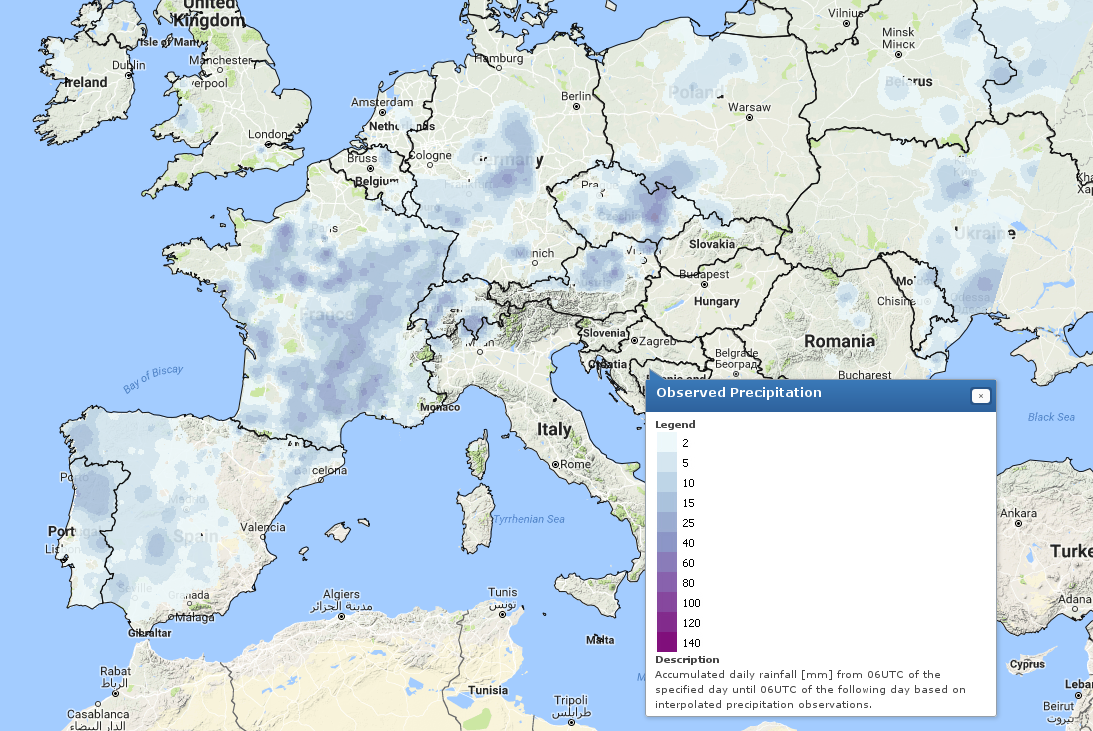
The precipitation data available to EFAS is interpolated to provide a map of accumulated precipitation for a 24h period ending at 06 UTC.
| Category | Meteorological forecast, Floods, flash-floods, debris flow and landslides |
|---|---|
| Coverage | Europe |
| Horizon | - |
| Time Resolution | 24 h |
| Spatial Resolution | 5 km |
| Update | 24 h |
| Nature | Raster Maps |
| Availability | Bulk data services, Geospatial data services, Product's catalogue |

