EDERA PLATFORM DOCUMENTATION
Table of contents
Using the platform
Back to toparrow_upwardThis is the main view of the platform.
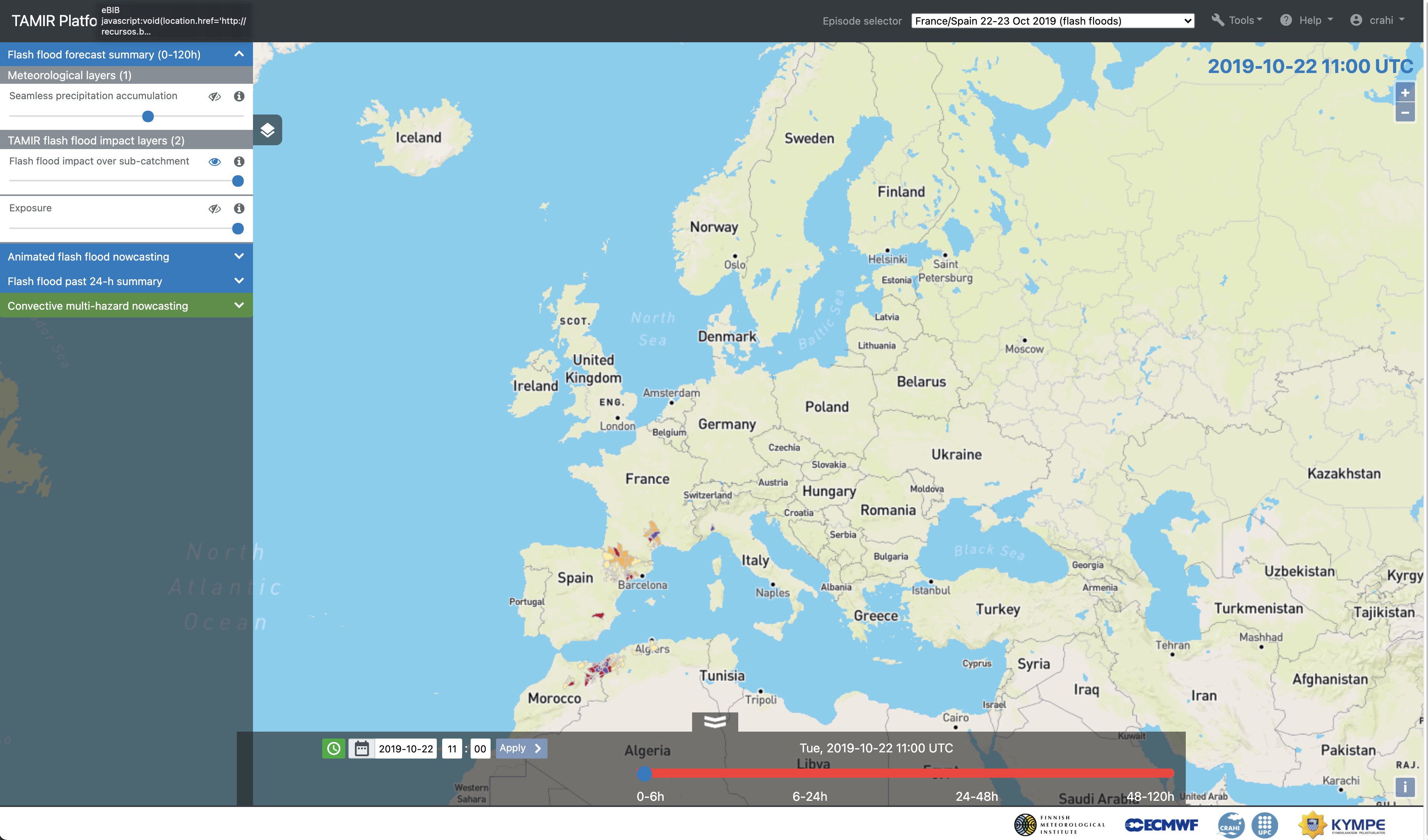
Try selecting one episode from the episode selector in the navigation bar (by default it will show the first one).

Once you have selected an episode, click the button on the left side to expand the sidebar.

There, you will find the different layers available. For each one of them you can show or hide them (eye icon), modify their opacity (slider) and show their description and palette colors.
When you have selected the desired layers you can pay attention to the frame selector at the bottom.
The first block has a frameselector adapted to the different leadtimes shown:

For the second and third blocks, a regular frame selector allows you to select different time steps, with the left part of the bar (in white) showing past time steps with the products estimated from observations, and the right part of the bar (in red) showing forecasts.

List of episodes
Back to toparrow_upwardThe list of case studies presented in the the platform is the following:
-
Helsinki (Finland), 12 Aug 2017 (convective multi-hazard)
-
Valencia (Spain), 10-15 Sep 2019 (flash floods)
-
Spain-France, 21-23 Oct 2019 (flash floods)
-
Zagreb (Croatia), 24 Jul 2020 (flash floods)
-
Scotland (UK), 10-12 Aug 2020 (flash floods)
-
Lisbon (Portugal), Feb 2021 (flash floods)
-
Southern Finland, 28 Aug 2023 (multi-hazard)
-
Helsinki (Finland), 31 Aug 2023 (flash floods)
-
Helsinki (Finland), 12 Aug 2017 (convective multi-hazard)
On August 12, 2017, the southern Finland was struck by a mesoscale convective storm called Kiira (name taken from the Finnish calendar). The storm was caused by warm air mass that arrived in Finland from the southern Europe. This caused a multi-hazard event. Strong downbursts brought down trees, resulted to disruptions in electricity distribution and caused damage to buildings. Around 6300 cloud-to-ground lightning flashes were observed in the Uusimaa region with up to 80 flashes/100 km2 during the event. Rainfall up to 30 mm/h and wind speeds up to 30 m/s were measured.
The storm had major impacts. Around 1000 rescue service tasks were reported and approximately 50000 customers suffered from electricity cuts. Water flooded into a shopping mall in Espoo. Air traffic in the southern Finland was severely disrupted and several airplanes destined to the Helsinki-Vantaa airport were diverted to Tampere. In addition, a large number of outdoor events were called off and people were evacuated to shelters. The Finnish insurance companies estimated that the damage done to forests was approximately 3 million euros. In the Kymenlaakso region, damage to electricity networks was estimated to be over 100 000 euros.
-
Valencia (Spain), 10-15 Sep 2019 (flash floods)
Period of flooding: 12 September 2019 at 0200 UTC – 15 September 2019 at 1600 UTC
Regions affected: Valencia, Spain (12 September 2019, at 0200-0900 and 1900-2000 UTC ), Balearic Islands (12 September 2019 at 0500 UTC), Castilla La Mancha (12 September 2019 at 0600 UTC), Murcia (12th September 2019 at 0900-1100 and 13 September 2019 at 0000-0400), Madrid (15 September 2019 at 1200 UTC), Castilla y Leon (15 September 2019 at 1600 UTC ). Other regions affected without specific timing information: Alicante, Albacete, Almeria, Malaga
Heavy rain began on 11 September 2019 and persisted for several days, totals in Valencia exceeded 400 mm. In total there were 6 fatalities and 3,500 people were evacuated (FloodList, 2019).

Location of the case (Valencia, Spain) in a map. -
Spain-France, 21-23 Oct 2019 (flash floods)
Period of flooding: 22 October 2019 at 1700 UTC - 23 October 2019 at 1700 UTC
Regions affected: Catalonia and Mallorca, Spain (22 October 2019 at 1700 UTC - 23 October 2019 at 0200 UTC), Var, Hérault, Aude, France (23 October 2019, 0500 - 1700 UTC)
A weather system brought heavy rain firstly to north-eastern Spain on the 22nd October 2019 before moving into southern France the next day. Some areas of Spain received over 200 mm of rain within 24 hours on the 22nd October, with a similar amount falling the next day in France, most of this was concentrated within a 3 hour period. In Catalonia, Spain there were 1,228 calls for assistance, 2 fatalities and 2 other people were reported missing (FloodList, 2019a). In France 1,000 people were rescued by the fire service, flood impacts were reported in the regions of Hérault, Bouches-du-Rhône, Var and Aude (FloodList, 2019b).
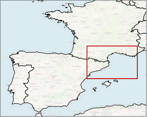
Location of the case (France and Spain) in a map. -
Zagreb (Croatia), 24 Jul 2020 (flash floods)
Period of flooding: 24 July 2020 at 1200 UTC - 25 July 2020 at 0600 UTC
Regions affected: Ličko- senjska (24 July 2020, 1200 - 1500 UTC), Zagreb (24 July 2020 at 1900 UTC - 25 July 2020 at 0000 UTC), Varaždinska (25 July 2020, 0500 - 0600 UTC)
Flash flooding associated with heavy rain occurred in Zagreb, Croatia on the evening of the 24 July 2020. Some areas received over 80 mm of rain in 3 hours, there were 350 interventions by the fire service and one fatality (Vujnovic, 2020). Reports of flash flooding were also received in other parts of Croatia, these were caused by storms associated with the same large scale synoptic pattern. The timeline of flash flood reports shows that most of the events occurred on 24 July 2020 between 2100-2200, there was an earlier instance of flash flooding in the coastal region of Ličko-senjska between 1300-1400.

Location of the case (Zagreb, Croatia) in a map. -
Scotland (UK), 10-12 Aug 2020 (flash floods)
Period of flooding: 11 August 2020 at 1700 UTC - 12 August 2020 at 0600 UTC
Regions affected: Borders (11 August 2020 , 1700 - 1900 UTC ), Fife (11 August 2020, 1900 - 2100 UTC), West Lothian (11 August 2020, 1900 - 2100 UTC), Perth (11 August 2020 at 2330 UTC - 12 August 2020 at 0100), Stonehaven - Aberdeenshire (12th August 2020, 0400 - 0600 UTC)
Thunderstorms and heavy rain began in the late afternoon of the 11th August 2020 in the Scottish borders where a major road south of Edinburgh was washed out. The rain moved north into Fife with flooding reported in Kirkcaldy and Cardenden. In Perth >100 properties were affected by flooding and a landslide in Stonehaven caused the derailment of a train leading to fatalities. SEPA report

Location of the case (Scotland) in a map. -
Lisbon (Portugal), 20 Feb 2021 (flash floods)
Period of flooding: 20 February 2021, 1000 - 1600 UTC
Regions affected: Lisbon, Portugal
A convective storm related to storm Karim brought heavy rain to Lisbon region. The district of Cascais was the worst affected with 48.2 mm falling in 6 hours. More information
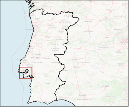
Location of the case (Lisbon, Portugal) in a map. -
Southern Finland, 28 Aug 2023 (multi-hazard)
Period of storm hazards: 28 Aug 2023 at 0700 UTC - 2000 UTC
Regions affected: Helsinki, Tampere, Tavastia, south Karelia, Savonia and the Kymenlaakso region
South and central Finland were affected by a major thunderstorm on 28 Aug 2023. Heavy rainfall was reported in southern and western Finland. Daily rainfall accumulation of 65 mm was measured in Tampere. Wind-related damages, such as fallen trees and major disruptions in electricity supply were reported across southern, central and eastern Finland.
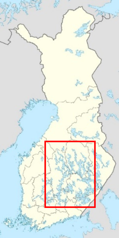
Location of the case (Southern Finland) in a map. -
Helsinki (Finland), 31 Aug 2023 (flash floods)
Period of storm hazards: 31 Aug 2023 at 0030 UTC - 0300 UTC
Regions affected: Helsinki and southwest Finland
A heavy thunderstorm arrived from the Baltic Sea in the early morning hours of 31 Aug 2023. Up to 19 millimeters of rainfall was measured in 10 minutes and up to 26 millimeters in one hour. Several buildings and underground tunnels were flooded in central Helsinki. One subway station was closed because of flooding. Heavy rainfall was also reported across southwest Finland.
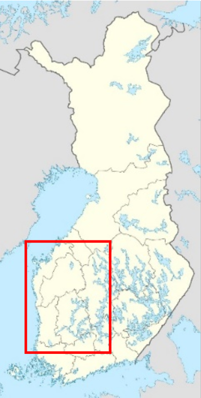
Location of the case (Helsinki) in a map.
Description of the EDERA layers
Back to toparrow_upwardList of layers
The layers are organised in four blocks:
-
First block: Flash flood forecast summary (0-120h)
Three products are generated within the EDERA project.
-
Seamless precipitation accumulations
Precipitation accumulations forecasted for the upcoming 5 days. The product is displayed as a summary for four lead time aggregation windows: (0-6h], (6-24h], (24-48h], (48-120h].
The precipitation accumulations have been obtained by seamless blending of the (i) 20-members ensemble of 1-h accumulation generated with the algorithm for probabilistic nowcasting by extrapolation of radar observations SBMcast (Berenguer et al., 2011) applied to the gauge-adjusted OPERA radar composites over Europe (2 km, 15 minutes; Park et al. 2019), and (ii) 51-members ensemble of 1-h accumulation forecasts obtained by Numerical Weather Prediction with the ECMWF Ensemble Prediction System (EPS).
The blending technique (Wong et al. 2009) is applied for the first 6 hours, and applies a phase shift and bias correction to blend radar nowcasts into NWP using a hyperbolic tangent weighting function. For lead times beyond 6 hours, the product relies only on the NWP forecasts.
The displayed accumulations correspond to the forecasts obtained with the control member.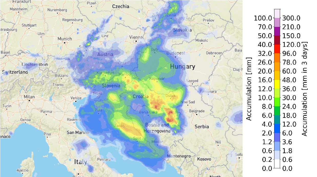
Seamless precipitation forecasts. -
Flash flood impact over sub-catchment
The flash flood impact level forecasted for the upcoming 5 days. This forecasted impact level is estimated by intersecting a flash flood hazard forecast with the exposure layer on a risk matrix. Both the flash flood hazard and the exposure data are split into three categories to create the risk matrix. The low, medium, and high values for flash flood hazard indicate where there is a 5%-50%, 50%-80%, and >80% probability of exceeding the 2-year return period threshold. This flash flood hazard is estimated by comparing blended forecasts of precipitation (from the OPERA radar mosaic and ECMWF NWP forecasts) accumulated on the river network, with the reference values derived from climatology. This climatology is from (i) 8-year gauge-adjusted OPERA data, and (ii) from a dataset of 20-year reforecasts obtained with ECMWF Integrated Forecasting System (IFS). The categories for low, medium, and high relative combined exposure respectively capture the variation in population density and critical infrastructure in rural, suburban, and urban areas in Europe. For more information on the exposure data, please see the documentation for that layer.
This gives impact levels for the river network cells. For each of the 4 lead time aggregation windows (0-6h, 7-24h, 25-48h, 49-120h), the cells show the maximum impact level forecasted throughout the window. To then provide a quicker overview of the affected areas, this sub-catchment overview is created by shading the sub-catchments according to the 90th percentile of the impact level of all cells forecasted within it. Use of the 90th percentile of impact (instead of the maximum) is to avoid communicating potentially misleadingly high forecast information to users based on single cell values.

Flash flood impact matrix. 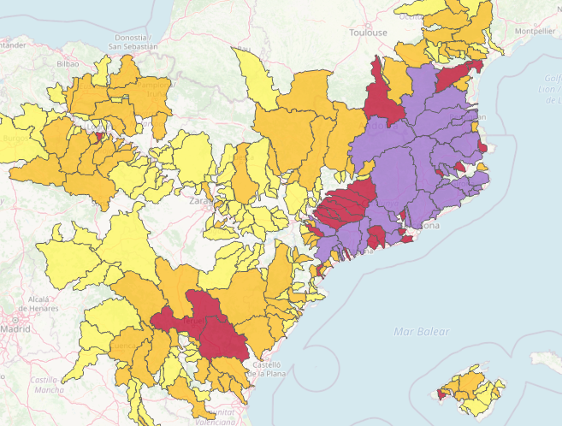
Flash flood impact map. -
Exposure
The combined relative exposure of the population, health and education facilities, and transport and energy infrastructure in each grid cell. For transport, roads, railways and airports are accounted for. For energy infrastructure, all types of powerplants are accounted for, but infrastructure for the distribution and transmission of electricity and gas is not. Cells showing greater exposure have one or more of: a high population density; a high number of health and education facilities; a large amount of infrastructure.
The data used to create this combined exposure layer are all openly available and either pan-European or global. GHSL Population (Global Human Settlement Layer) data from the 2015 epoch was used for population. For the other four exposure categories (health, education, transport, energy) a combination of OSM (OpenStreetMap) data and data from the ‘HARmonized grids of Critical Infrastructure in EUrope’ (HARCI-EU) was used. Each dataset was reprojected and cropped to the TAMIR/EFAS spatial domain (if necessary), then transformed for normality. The datasets were then rescaled between 1 and 2 to give them a common scale, added together, and then rescaled again. This gave the combined exposure layer shown in the map viewer.
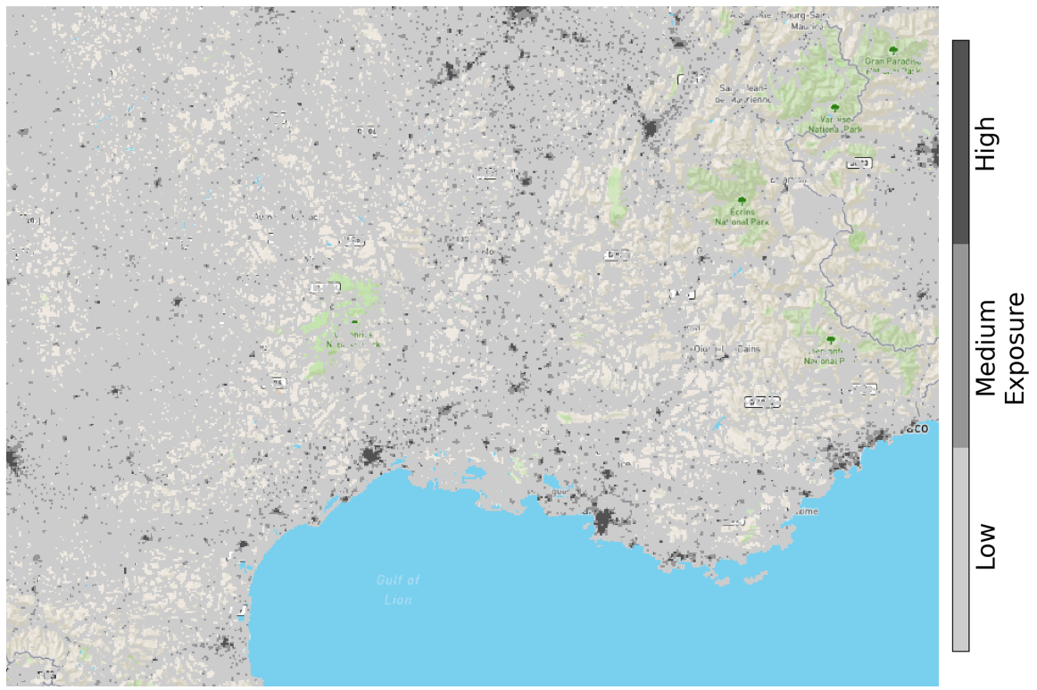
Exposure map.
-
-
Second block: Animated Flash Flood nowcasting
The flash flood nowcasts up to 6 hours are animated with 1 hour window to show the evolution of near-future situation awareness.
-
Seamless 1h precipitation accumulation forecast
1-h precipitation accumulations forecasted for the upcoming 6 hours obtained by seamless blending of the (i) 20-members ensemble of 1-h accumulation generated with the algorithm for probabilistic nowcasting by extrapolation of radar observations SBMcast (Berenguer et al., 2011) applied to the gauge-adjusted OPERA radar composites over Europe (2 km, 15 minutes; Park et al. 2019), and (ii) 51-members ensemble of 1-h accumulation forecasts obtained by Numerical Weather Prediction with the ECMWF Ensemble Prediction System (EPS).
The blending technique (Wong et al. 2009) is applied for the first 6 hours, and applies a phase shift and bias correction to blend radar nowcasts into NWP using a hyperbolic tangent weighting function.
The displayed accumulations correspond to the forecasts obtained with the control member.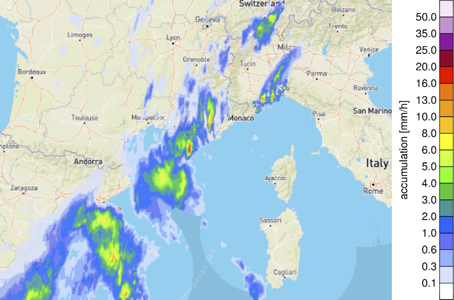
Seamless 1h accumulation forecast map. -
Flash flood hazard
Hourly forecasts of flash flood hazard levels over the river network for the next 6 hours. Flash flood hazard is split into 3 categories: low, medium, and high values, that indicate where there is a 5%-50%, 50%-80%, and >80% probability of exceeding the 2-year return period threshold. This flash flood hazard is estimated by comparing the precipitation from the blending of the OPERA radar mosaic derived nowcasts and forecasts from the ECMWF IFS (Integrated Forecast System), to the reference values derived from a climatology created using: (i) 8-year gauge-adjusted OPERA data, and (ii) a dataset of 20-year reforecasts obtained with the ECMWF IFS (Integrated Forecast System).

Flash flood hazard. -
Flash flood impact over the river network
Hourly forecasts of flash flood impact levels over the river network for the next 6 hours. The forecasted impact level is estimated by combining the hourly flash flood hazard forecasts with the exposure layer on a risk matrix. Both the flash flood hazard and exposure data are split into 3 categories to create the risk matrix. The low, medium, and high values for flash flood hazard indicate where there is a 5%-50%, 50%-80%, and >80% probability of exceeding the 2-year return period threshold. This flash flood hazard is estimated by comparing the precipitation from the blending of the OPERA radar mosaic derived nowcasts and forecasts from the ECMWF IFS (Integrated Forecast System), to the reference values derived from a climatology created using: (i) 8-year gauge-adjusted OPERA data, and (ii) a dataset of 20-year reforecasts obtained with the ECMWF IFS (Integrated Forecast System). The categories for low, medium, and high relative combined exposure respectively capture the variation in population density and critical infrastructure in rural, suburban, and urban areas in Europe. For more information on the exposure data, please see the documentation for the exposure layer.


Flash flood impact map. -
Flash flood impact over sub-catchment
Hourly forecasts of flash flood impact levels for the next 6 hours, summarised by sub-catchment. This forecasted impact level is estimated by intersecting a flash flood hazard forecast with the exposure layer on a risk matrix. Both the flash flood hazard and the exposure data are split into three categories to create the risk matrix. The low, medium, and high values for flash flood hazard indicate where there is a 5%-50%, 50%-80%, and >80% probability of exceeding the 2-year return period threshold. This flash flood hazard is estimated by comparing the precipitation from the blending of the OPERA radar mosaic derived nowcasts and forecasts from the ECMWF IFS (Integrated Forecast System), to the reference values derived from a climatology created using: (i) 8-year gauge-adjusted OPERA data, and (ii) a dataset of 20-year reforecasts obtained with the ECMWF IFS (Integrated Forecast System). The categories for low, medium, and high relative combined exposure respectively capture the variation in population density and critical infrastructure in rural, suburban, and urban areas in Europe. For more information on the exposure data, please see the documentation for the exposure layer.
The procedure described above gives impact levels for the river network cells. To provide a quicker overview of the affected areas, this sub-catchment overview is created by shading the sub-catchments according to the 90th percentile of the impact level of all cells forecasted within it. Use of the 90th percentile of impact (instead of the maximum) is to avoid communicating potentially misleadingly high forecast information to users based on single cell values.

Flash flood impact matrix. 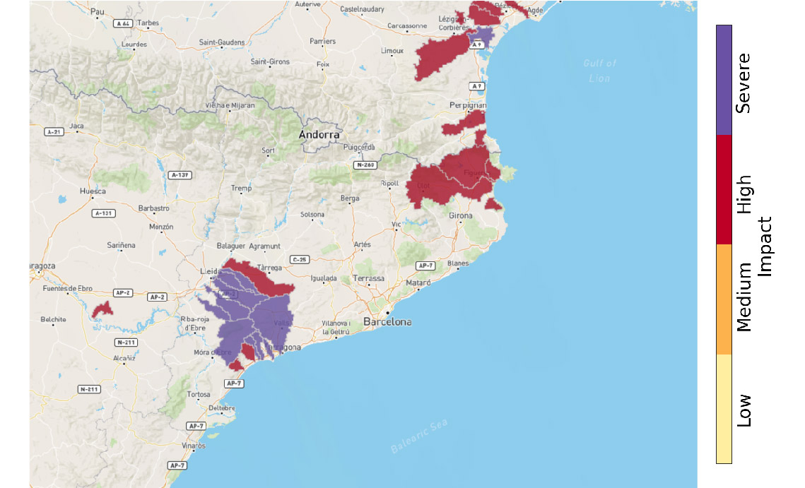
Flash flood impact map. -
Exposure
The combined relative exposure of the population, health and education facilities, and transport and energy infrastructure in each grid cell. For transport, roads, railways and airports are accounted for. For energy infrastructure, all types of powerplants are accounted for, but infrastructure for the distribution and transmission of electricity and gas is not. Cells showing greater exposure have one or more of: a high population density; a high number of health and education facilities; a large amount of infrastructure.
The data used to create this combined exposure layer are all openly available and either pan-European or global. GHSL Population (Global Human Settlement Layer) data from the 2015 epoch was used for population. For the other four exposure categories (health, education, transport, energy) a combination of OSM (OpenStreetMap) data and data from the ‘HARmonized grids of Critical Infrastructure in EUrope’ (HARCI-EU) was used. Each dataset was reprojected and cropped to the TAMIR/EFAS spatial domain (if necessary), then transformed for normality. The datasets were then rescaled between 1 and 2 to give them a common scale, added together, and then rescaled again. This gave the combined exposure layer shown in the map viewer.

Exposure map.
-
-
Third block: Flash flood past 24-h summary
To overview what has actually happened in a previous day, several auxiliary estimates based on the observations are displayed.
-
Precipitation accumulation (24h)
Daily precipitation accumulation estimated from gauge-adjusted OPERA radar composites.
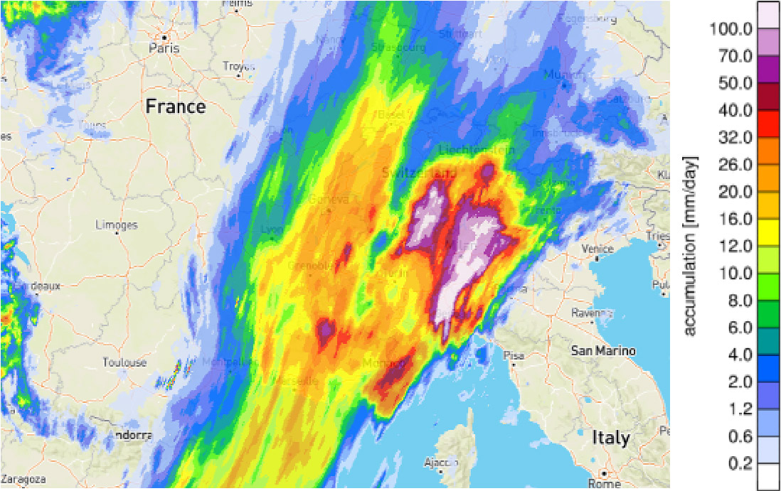
24h precipitation accumulation. -
Rain gauge accumulation (24h)
Daily rain gauge accumulations reported from WMO SYNOP gauges over Europe and AEMET over Spain.

Rain gauge accumulation 24h map. -
Flash flood hazard summary (24h)
The maximum flash flood hazard level over the river network over the past 24h. Flash flood hazard is split into 3 categories: low, medium, and high values, that indicate where there is a 5%-50%, 50%-80%, and >80% probability of exceeding the 2-year return period threshold. This flash flood hazard is estimated by comparing the precipitation from the blending of the OPERA radar mosaic derived nowcasts and forecasts from the ECMWF IFS (Integrated Forecast System), to the reference values derived from a climatology created using: (i) 8-year gauge-adjusted OPERA data, and (ii) a dataset of 20-year reforecasts obtained with the ECMWF IFS (Integrated Forecast System).

24-h flash flood hazard summary. -
Flash flood impact summary over the river network (24h)
The maximum flash flood impact level over the river network over the past 24h. The impact level is estimated by intersecting a flash flood hazard forecast with the exposure layer on a risk matrix. Both the flash flood hazard and exposure data are split into 3 categories to create the risk matrix. The low, medium, and high values for flash flood hazard indicate where there is a 5%-50%, 50%-80%, and >80% probability of exceeding the 2-year return period threshold. This flash flood hazard is estimated by comparing hourly observations of catchment-aggregated precipitation (from the blending of OPERA radar mosaic with short-range forecasts from the ECMWF IFS (Integrated Forecast System) with reference values derived from a climatology created using: (i) 8-year gauge-adjusted OPERA data, and (ii) a dataset of 20-year reforecasts obtained with ECMWF Integrated Forecast System (IFS). The categories for low, medium, and high relative combined exposure respectively capture the variation in population density and critical infrastructure in rural, suburban, and urban areas in Europe. For more information on the exposure data, please see the documentation for the exposure layer.
The procedure above gives hourly impact levels for the river network cells. To provide a summary over the 24h period, the impact shown in each river network cell is the maximum impact forecasted in the 24 hourly forecasts produced.
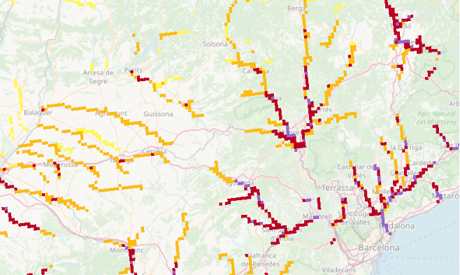
Flash flood impact summary map. -
Flash flood impact summary over sub-catchment (24h)
The maximum flash flood impact level over the river network over the past 24h. The impact level is estimated by intersecting a flash flood hazard forecast with the exposure layer on a risk matrix. Both the flash flood hazard and exposure data are split into 3 categories to create the risk matrix. The low, medium, and high values for flash flood hazard indicate where there is a 5%-50%, 50%-80%, and >80% probability of exceeding the 2-year return period threshold. This flash flood hazard is estimated by comparing the hourly observations of catchment-aggregated precipitation (derived from the blending of observations from the OPERA radar mosaic and short-range NWP forecasts from the ECMWF IFS (Integrated Forecast System) with reference values derived from a climatology of 8-year gauge-adjusted OPERA data. The categories for low, medium, and high relative combined exposure respectively capture the variation in population density and critical infrastructure in rural, suburban, and urban areas in Europe. For more information on the exposure data, please see the documentation for the exposure layer.
This gives hourly impact levels for the river network cells over the previous 24 hours. The maximum value over this time period is identified in each river network cell. To then provide a quicker overview of the affected areas, this sub-catchment overview is created by shading the sub-catchments according to the 90th percentile of the impact level of all cells forecasted within it. Use of the 90th percentile of impact (instead of the maximum) is to avoid communicating potentially misleadingly high forecast information to users based on single cell values.

Flash flood impact summary map.
-
-
Fourth block: Convective multi-hazard nowcasting
To overview what has actually happened in a previous day, several auxiliary estimates based on the observations are displayed.
-
Radar reflectivity
Reflectivity is the variable measured by radars. It relates to rain rate, R, through a relationship of the kind Z=aRb (where a and b are parameters that depend on the type of precipitation).
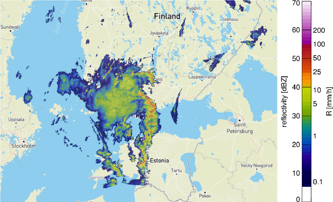
Reflectivity -
Hazard probability nowcast
This layer shows a weather radar-based nowcasting product for multi-hazards caused by thunderstorms (heavy rainfall, wind gusts, hail, and lightning).
The product combines a cell-based storm nowcast model with a machine learning classification which estimates the hazard level of convective storm based on historical meteorological observations and emergency calls following the concepts described by Rossi et al. (2013) and Tervo et al. (2019).
It uses meteorological data from various sources such as weather radar, Numerical Weather Prediction (NWP) models, re-analysis data and lightning observations. The performance of the classifier has been verified against past cases and has been observed to perform reasonably well. The trained classification model is then used to classify thunderstorms in real-time. This is based on weather radar measurements that are complemented by other meteorological observations. Probabilistic nowcasts for the future location of the classified thunderstorms for the coming 5-60 minutes are being produced using an ensemble-based on Kalman filter model (Rossi et al. 2015).The product generation can be described as follows. The storm cells are identified from the radar reflectivity field and described by ellipses. The hazard levels of the cells are then predicted with the machine-learning scheme utilizing the history information of the past storms. The given value is defined from the meteorological observations every 5 minutes. The cells with the assigned hazard classes are preseted as a product layer. Their nowcast up to one-hour lead time is provided. The uncertainty is represented by the increasing transparency of the ellipse increasing with the lead time:
The product is demonstrated on the EDERA platform for a thunderstorm Kiira, occuring in August 2017 in Finland, which is shown in Figures 2 and 3.
Figure 1. Different stages of generating the multi-hazard product for thunderstorms. 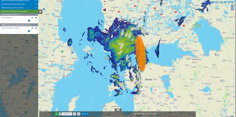
Figure 2. The storm hazard level classification (colored ellipses) for the identified storm cells and the radar reflectivity field in the background. Gray represents no hazard and orange represents severe hazard.
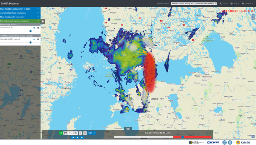
Figure 3. The predicted storm cells depicted as ellipses (lead time 15 minutes). Gray represents no hazard and red represents extreme hazard. -
Storm impact layers
The storm Impact layers show nowcasts (short-range forecasts) of hazards and impacts caused by thunderstorms. Separate layers are implemented for the total storm hazard level and four different hazard types: heavy rainfall, wind gusts, hail, and lightning. These products combine cell-based storm nowcasts with a machine learning (ML) model. The ML model estimates the current storm hazard level based on historical weather radar observations and ERA5 reanalyses. It is trained by using archived severe weather reports from the European Severe Weather Database (href="https://eswd.eu"). The storm hazard and impact nowcasts are generated by combining the predicted hazard levels with probabilistic predictions of storm locations. The storm locations are predicted for the next 4 hours by using a Kalman filter-based method (Rossi et al. 2015). The product generation is done every 15 minutes at 2 km spatial resolution with 15-minute time steps and maximum lead time of 4 hours. For a description of the methodology, see Rossi et al. (2013, 2015) and Tervo et al. (2019).
The product generation process for the chosen time is illustrated in the image. Storm cells are identified and tracked from OPERA reflectivity composites (step 1). Hazard levels of the cells are then predicted with the ML model for the four different hazard types. This is done by using meteorological information from additional data sources, such as ERA5 reanalyses (step 2). Ellipses are fitted to the storm cells, and probabilistic nowcasts of storm ellipse locations are produced by applying the Kalman filter-based model (step 2). The predicted hazard levels are combined with the storm locations, which gives the hazard nowcasts (step 3). Here we assume that the hazard levels remain constant during the forecast time range. The increasing uncertainty in the storm location is represented by the increasing transparency and spread of the ellipses as the forecast lead time is increased. The storm nowcast giving the total hazard level is generated by taking the maximum levels from each hazard type (heavy rainfall, wind gusts, hail and lightning). Finally, the total hazard nowcast is combined with exposure layer to produce impact nowcast (step 4). This is done by using a single exposure data source combined from openly available datasets of population, transport and critical infrastructure (e.g. health, education and energy).
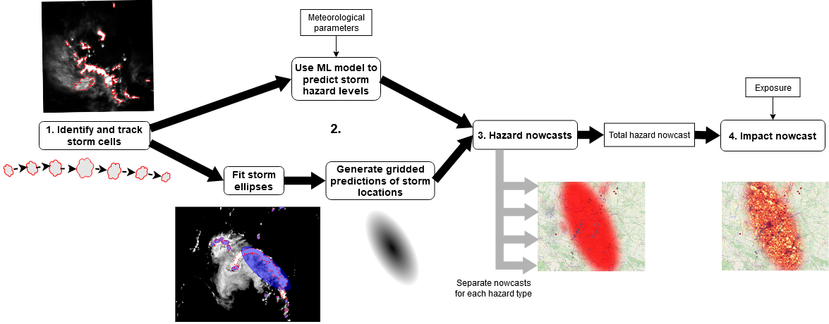
Different stages of generating the storm impact products.
-
References
-
Berenguer, M., Sempere-Torres, D., Pegram, G.G., 2011. SBMcast - An ensemble nowcasting technique to assess the uncertainty in rainfall forecasts by Lagrangian extrapolation. J. Hydrol 404, 226-240. https://doi.org/10.1016/j.jhydrol.2011.04.033
-
Park S., Berenguer, M., Sempere-Torres, D., 2019. Long-term analysis of gauge-adjusted radar rainfall accumulation at the European scale. J. Hydrol. 573, 768-777. https://doi.org/10.1016/j.jhydrol.2019.03.093
-
Wong, W.K., Yeung, H.Y., Wang Y.C., and Chen, M., 2009. Towards the Blending of NWP with Nowcast - Operation Experience in B08FDP. WMO Symposium on Nowcasting, 30 Aug - 4 Sept 2009, Whistler, B.C., Canada. [Link]
-
Rossi, P.J., Hasu, V., Halmevaara, K., Mäkelä, A., Koistinen, J., Pohjola, H., 2013. Real-Time Hazard Approximation of Long-Lasting Convective Storms Using Emergency Data. J. Atmos. Oceanic Technol. 30, 538–555. https://doi.org/10.1175/JTECH-D-11-00106.1
-
Rossi, P.J., Chandrasekar, V., Hasu, V., Moisseev, D., 2015. Kalman Filtering–Based Probabilistic Nowcasting of Object-Oriented Tracked Convective Storms. J. Atmos. Oceanic Technol. 32, 461–477. https://doi.org/10.1175/JTECH-D-14-00184.1
-
Tervo, R., Karjalainen, J., Jung, A., 2019. Short-Term Prediction of Electricity Outages Caused by Convective Storms. IEEE Transactions on Geoscience and Remote Sensing 57, 8618–8626. https://doi.org/10.1109/TGRS.2019.2921809